Our Services
Delve into superior accuracy and immersive visualization via our advanced reality capture offerings. Harnessing our top-tier technology, we deliver unmatched insights, granting clients a distinct competitive advantage through meticulous data gathering, refining operations and amplifying project outcomes.
LiDAR Capture
Dive into unmatched precision with our LiDAR Capture services. Leveraging both airborne and terrestrial LiDAR, we deliver deep insights into structures and terrains, transforming data seamlessly into detailed designs. Key Features include:
- Dual Mode Scanning: Cover vast areas from the sky and ground-level details for comprehensive data capture.
- High-Def Scans: Capture intricate details with accuracy, enhancing modeling and analysis.
- Swift Data Acquisition: State-of-the-art equipment ensures rapid yet precise scanning.
- Data Conversion: Convert raw LiDAR data into precise topographical land surveys, facilitating seamless design and planning. Effortlessly eliminate vegetation and navigate down to grade.
- Design Software Integration: Compatibility with top design tools like CAD or Revit.
Virtual Tours
Dive into the next-gen property showcasing and inspection with our Virtual Tours. Experience properties in vivid 3D, allowing users to explore every detail from any location. These immersive tours redefine remote property viewing, making it both engaging and detailed. Key features include:
- Ultra-High Definition: Capture every detail, from wall textures to wood grains.
- 360-Degree Views: Full property navigation for a comprehensive view.
- Interactive Hotspots: Click to uncover details like construction materials or architectural insights.
- Intuitive Navigation: User-friendly interface suitable for all tech levels.
- Mobile + VR Ready: Immerse yourself in the property with the convenience of quick mobile viewing or delve into a fully immersive VR experience.
Floor Plans
Experience the future of architectural and interior planning with our digital floor plans. Merging detailed precision with visual elegance, our floor plans are essential tools for informed decisions and successful project implementations. Key features include:
- Crisp Graphics: High-resolution designs suitable for presentations and detailed reviews.
- Precise Layout Information: Every room's dimensions and the total square footage meticulously documented.
- Versatile Formats: Available in any image format, ensuring easy sharing and compatibility with various tools.
- 24-Hour Delivery: Designed for the fast-paced world of modern design.
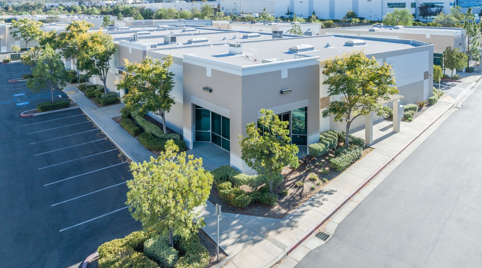
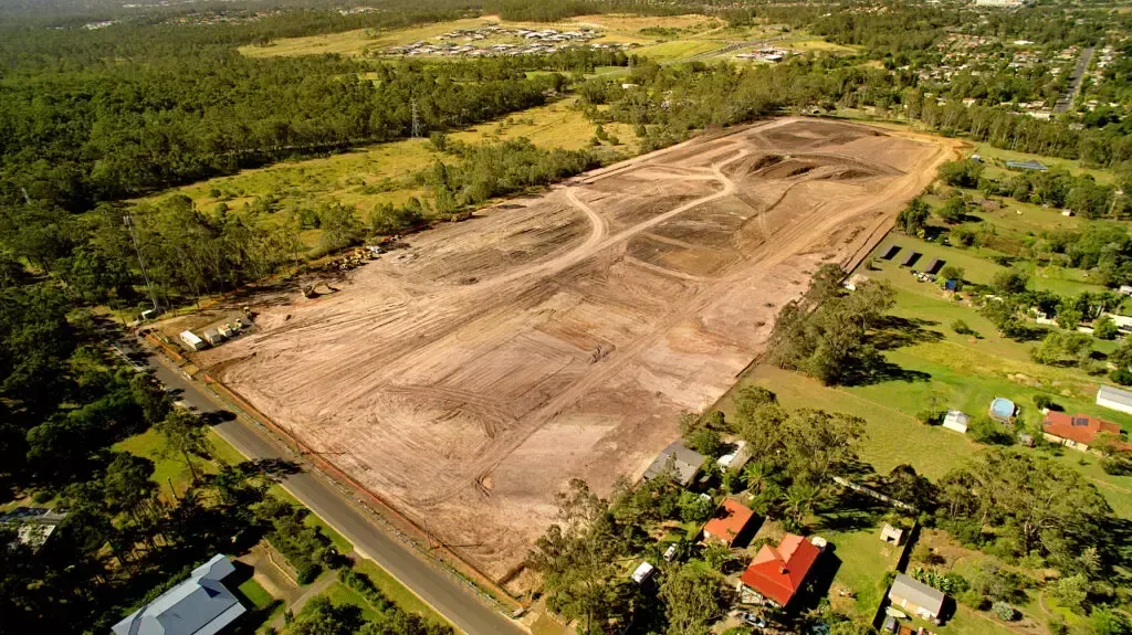
Drone Solutions
Experience elevated insights with our advanced Drone Solutions. Combining HD imagery and LiDAR precision, we deliver comprehensive aerial data for diverse needs, from property displays to terrain analysis and project tracking. Key features include:
Cutting-Edge Drones: Equipped with top-tier cameras and LiDAR for optimal data capture.
Property Visualization: Capture stunning photos and videos from unique perspectives, perfect for marketing, presentations, and documentation.
Precision Terrain Mapping: LiDAR-enhanced topographical models for various industries.
Project Updates: Regular aerial documentation ensures project transparency and accuracy.
Data Transformation: Convert raw data into actionable formats like high-res images, 3D models, or elevation maps. Easily strip vegetation down to grade for maximum insights.
Construction Progression
Our Construction Progression Capture chronicles every stage of your project, from groundbreaking to completion. We kick off with a detailed site survey and collaboration with your team to plan the perfect photographic narrative. Key features include:
- 4 Point MEP Capture: Capture Framing, Plumbing, Electrical, and HVAC for later recall when problems arise.
- Scheduled Milestone Capture: 360° immersive images captured at key intervals to highlight progress.
- Drone Photography: Offering expansive shots and unique angles that previously were unreachable.
- Time-Lapse Photography: A condensed visual showcase of your site's transformation, ideal for presentations and marketing.
BIM Modeling
In the modern world of construction and design, our Scan to BIM services are a forefront solution, blending precision with innovation. We use top-tier technology to convert detailed scans into comprehensive 3D models, combining real-world structures with their digital twins. Key Features Include:
- Site Scanning: Using state-of-the-art LiDAR, we capture every detail of the site.
- 3D Modeling: Our experts transform scans into precise and visually appealing 3D models.
- Software Integration: Easily import into Revit or any CAD software.
- Real-time Collaboration: BIM's digital nature lets stakeholders concurrently work, revise, and resolve issues.
Our Clients
Collaborating with a broad array of industry pioneers enables us to finely calibrate our services to meet the unique requirements of your project. Our expertise lies in devising strategies that elevate the impact of your initiatives.


Infrastructure